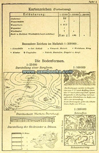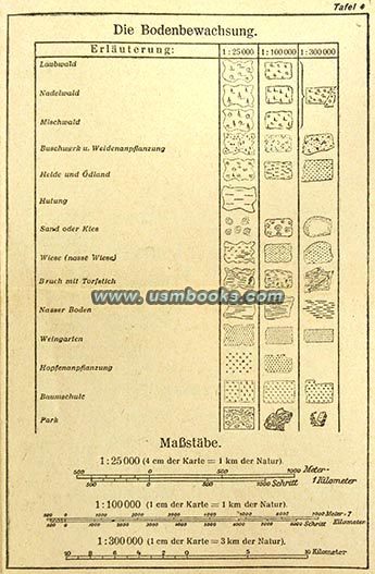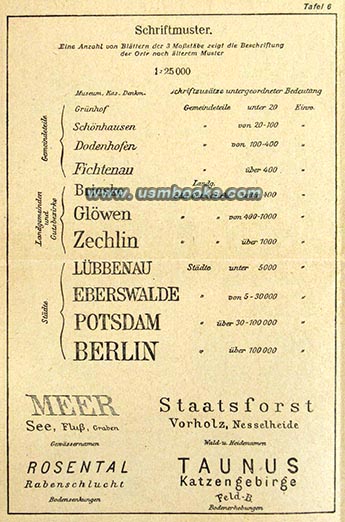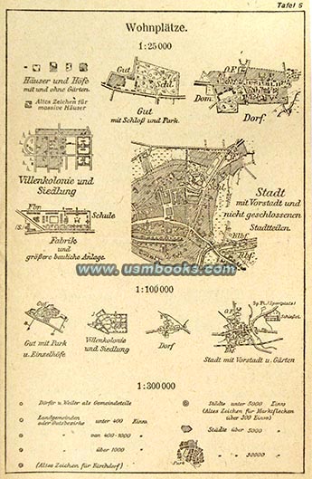
Kartenzeichen für die Maßstäbe is a handy fold-out guide explaining how to read Nazi maps. The nine Tafel or Tables cover abbreviations on maps, scales and cartographic symbols of borders, rivers, towns and cities, railroads, terrain, and so on, all clearly explained and illustrated.
Folded up this interesting two-sided piece of Third Reich ephemera measures 4-1/4 x 6-5/8 inches and unfolded the length is 21 inches. It was published by Verlag des Reichamts für Landesaufnahme, the State Agency of Geologic Surveying in Berlin. It is undated but judging from the Nazi eagle and swastika on its cover panel, clearly dates to the Third Reich.
Everybody with a Third Reich map needs one of these! Condition exactly as shown.
 |
 |


Have a look at the large selection of original Nazi maps for sale on USMBOOKS.com. We are happy to combine shipping of multiple purchases!
| • IF you prefer faster and safer Priority Mail shipping with USPS Tracking add $8.95. |
| • IF you wish to purchase highly recommended, but optional insurance, add $3.50. |
| • We will be happy to ship abroad at additional cost, however foreign customers are responsible for any VAT payments, import duties and clearing fees. Please inquire. |
HANDY INSTRUCTIONS ON HOW TO READ A NAZI MAP
KARTENZEICHEN
CLEARLY EXPLAINED
AND ILLUSTRATED BY
THE NAZI STATE AGENCY OF GEOLOGICAL SURVEYING


