The images and text used on this and all other USM web pages are the copyrighted property
of USM Inc. Those images and the text may be used by others ONLY AFTER completion
of a formal international licensing agreement and payment of a licensing fee!
of USM Inc. Those images and the text may be used by others ONLY AFTER completion
of a formal international licensing agreement and payment of a licensing fee!
Have a look at other original Third Reich maps
for sale on USMBOOKS.com.
**SOLD** |
| • IF you prefer Priority Mail shipping with USPS delivery confirmation add $5.75. |
| • IF you wish to purchase highly recommended, but optional insurance, add $2.75. |
| • We will be happy to ship abroad at additional cost. Please inquire. |

![Sudetenland and the [Nazi] Protectorate of Bohemia and Moravia](images/MAPS/B&Mmaps2.jpg)
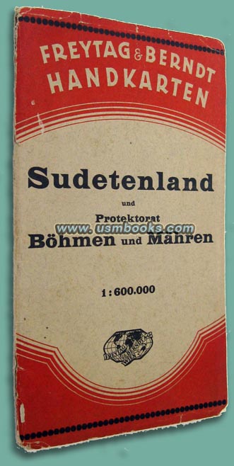
This 5-7/8 x 9-3/4 inch folder contains a 25 x 33 inch Third Reich map of Sudetenland und Protektorat Böhmen und Mähren (Sudetenland and the [Nazi] Protectorate of Bohemia and Moravia) published by Freytag & Berndt. The map is not dated, we suspect it was produced shortly after this area became part of Adolf Hitler's Greater German Reich in 1939.
The multi-color Nazi Freytag & Berndt Handkarte is at a scale of 1: 600,000 (1 cm = 6 km) and shows all of the normal roads, Reichsautobahn freeways, cities and towns. The former country of Czechoslovakia is bordered by Schlesien, Slowakei, Reichsgau Oberdonau, Gau Niederdonau, Bayern and Sachsen on this historic map.
Very detailed, nice used condition. Cover has G. Freytag & Berndt AG advertising on the back and shows wear to spine (see photo left).
LARGE NAZI MAP SUDETENLAND, BOHEMIA, MORAVIA
ORIGINAL THIRD REICH FREYTAG & BERNDT MAP
OF SUDETENLAND, PROTEKTORAT BÖHMEN
UND MÄHREN
This USM Books website is Copyright © 2012 by USM, Inc., and the text and images on it are fully protected by international copyright law. It is therefore, illegal for anyone to take any of the material found here and use it for their own purposes without our written permission, irrespective of any excuse they may feel they have for doing so.


