|
|
 |
the location of the Ford factory . |
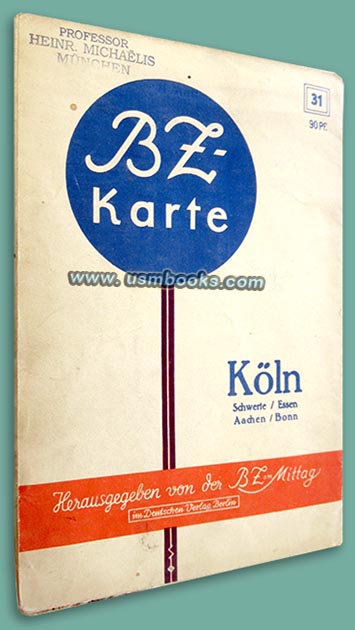
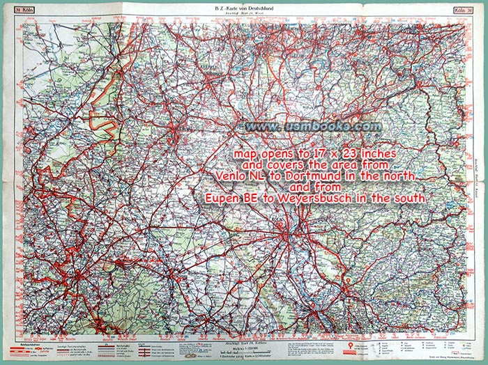
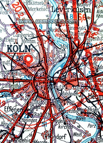
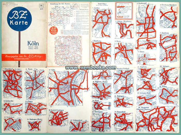
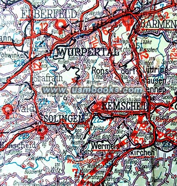
This is a very nice example of the two-sided Third Reich color map BZ-Karte 31 of Köln and the area around it including Aachen, Bonn, Oberhausen, Jülich, Solingen, Lüdenscheid, Dortmund, Duisburg, Düren, Eschweiler, Düsseldorf, Essen, Remscheid and Wuppertal. The BZ in the name of the map stands for Berliner Zeitung, the Berlin publisher of this 17 x 23 inch detailed color map.
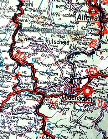
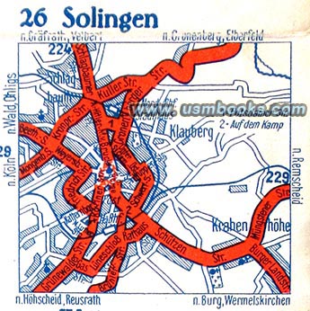
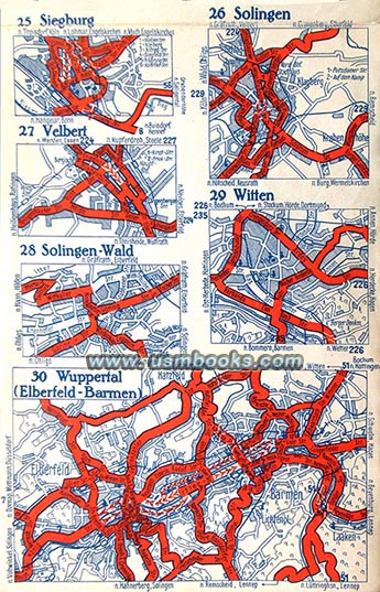
The map has highways and smaller roads, as well as finished stretches of the Reichsautobahn and sections of the Nazi freeway system that were under construction. On the back side are city maps with major streets marked in bold red. This map would be perfect for a Nazi dagger, sword or badge collector as the area (and map) includes important cities such as Solingen and Lüdenscheid, the center of that industry during the Third Reich.
The map has highways and smaller roads, as well as finished stretches of the Reichsautobahn and sections of the Nazi freeway system that were under construction. On the back side are city maps with major streets marked in bold red. This map would be perfect for a Nazi dagger, sword or badge collector as the area (and map) includes important cities such as Solingen and Lüdenscheid, the center of that industry during the Third Reich.
Folded up this 80+ year old Nazi BZ-Karte 31 Köln measures 8-1/2 x 5-5/8 inches. It is in very nice condition. There are small tears at the outside end of some of the folds. The colors are bright, no tape, no odor. This is a rare map!
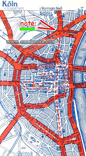
While this map is not dated, it was clearly produced during the Third Reich! As you can see in the image below, like just about every other city in Germany, there was an Adolf Hitler Platz (square) in Cologne very near to the famous cathedral!
 |
Germany's dagger, sword and badge industry |
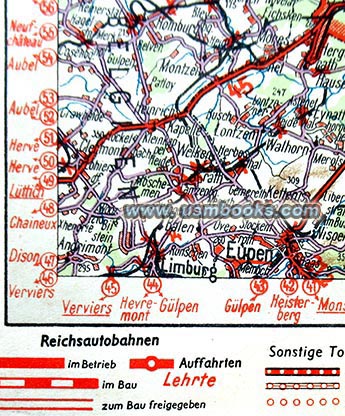
This is a very historic Third Reich map for another reason. Both Eupen and Malmedy are part of Nazi Germany on this World War II era German map. This small, predominantly German-speaking region in eastern Belgium was ceded to Belgium in 1920 according to the terms of the Treaty of Versailles. However, after Germany invaded Belgium in May 1940 the country was quickly occupied, and on 18 May Hitler announced the re-integration of Eupen-Malmedy into Germany while the rest of Belgium remained under military occupation. This map was printed after 18 May 1940 as there is no border between Eupen - Malmedy and Nazi Germany anymore.
Have a look at other original Third Reich civilian & military maps
for sale on USMBOOKS.com. We are happy to combine
shipping of multiple purchases!
| • IF you prefer faster and safer Priority Mail shipping with USPS Tracking add $8.95. |
| • IF you wish to purchase highly recommended, but optional insurance, add $3.50. |
| • We will be happy to ship abroad at additional cost, however foreign customers are responsible for any VAT payments, import duties & customs clearing fees. Please inquire. |
ORIGINAL WORLD WAR II GERMAN MAP OF
COLOGNE AND THE SURROUNDING AREA
BZ-AUTOKARTE 31 KÖLN
A BIG 2-SIDED NAZI COLOR MAP INCLUDING INCLUDING AACHEN, BONN, SOLINGEN, LUDENSCHEID, DORTMUND, VENLO (HOLLAND), EUPEN & MALMEDY (BELGIUM),