The images and text used on this and all other USM web pages are the copyrighted property
of USM Inc. Those images and the text may be used by others ONLY AFTER completion
of a formal international licensing agreement and payment of a licensing fee!
of USM Inc. Those images and the text may be used by others ONLY AFTER completion
of a formal international licensing agreement and payment of a licensing fee!

|
||

|

|

|

|
||
Have a look at other Third Reich maps and atlas books
for sale on USMBOOKS.com.
USM book #471 |
| • IF you prefer Priority Mail shipping with USPS delivery confirmation add $5.95. |
| • IF you wish to purchase highly recommended, but optional insurance, add $2.45. |
| • We will be happy to ship abroad at additional cost. Please inquire. |
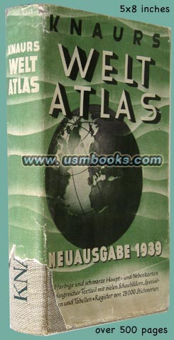
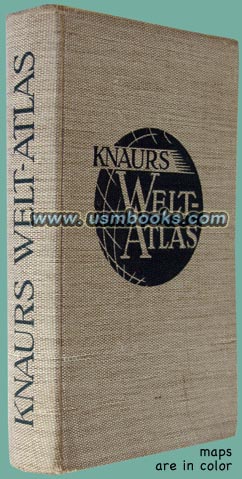
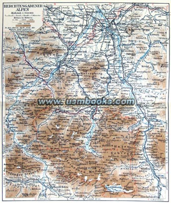
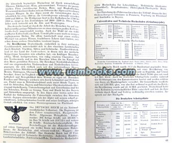
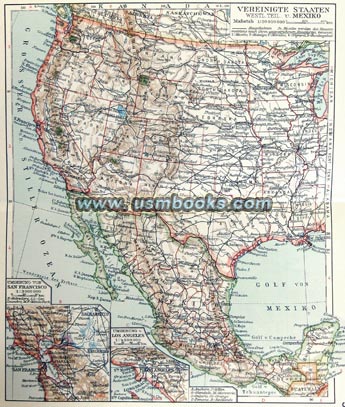
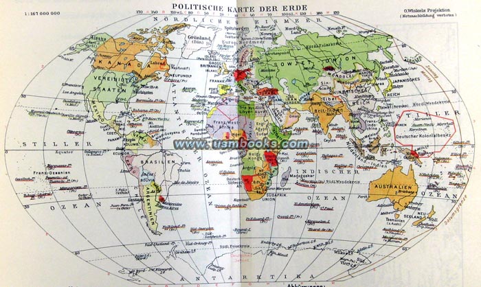
The Third Reich Knaurs Weltatlas or Knaurs World Atlas was an essential reference book for professionals, as well as for educators and students at school and at home. With maps and text it shows in-depth current 1939 geographical, political and economic information for Europe and the rest of the world. Printed in late 1939, this hard cover Knaurs Weltatlas measures 5 x 8 inches, has over 500 pages with 130 color and black & white maps, as well as dozens of tables and illustrations.
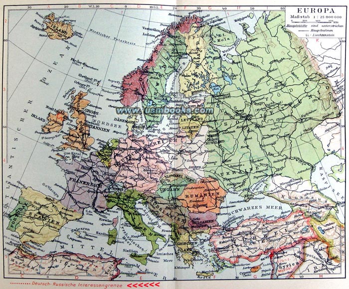
In the October 1939 foreword the publisher Th. Knaurs Nachfolger of Berlin mentioned the political changes in Europe, and the updated maps and information show the expansion of Adolf Hitler's Greater Germany: the reunification of Memelland and Danzig with Germany as well as the Protectorate of Bohemia and Moravia as well as the independence of Slovakia. Note the very interesting notation in the lower left corner of the first photo above about the "German-Russian Interest Border". Rarely is it mentioned today that Russia also invaded Poland in 1939!
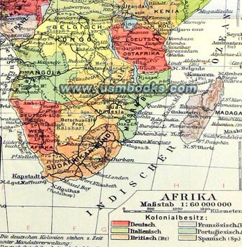
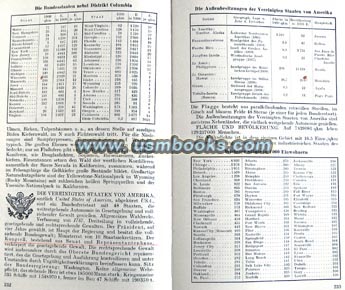
The book contains information on geography, geology, population, religion, colonies, and languages for each country in the world, starting with the Deutsches Reich of Adolf Hitler and continuing with countries like the USA, Mexico, Switzerland, Belgium, Hungary, Liechtenstein, Great Britain, Fascist Italy, Portugal, the Baltic countries, Japan, the Dutch East Indies, South Africa, Iran, Afghanistan, Ceylon, Nepal, Cuba, Haiti, the Dominican Republic, the Dutch Antilles, Venezuela, Puerto Rico, Bhutan, Iran, Chile, Paraguay, Argentina, Australia, etc., etc.
Great maps, fully indexed, complete and in very good used condition. Some underlining in the text in pencil. With rare original (but somewhat damaged) dust jacket. If you need an excellent atlas of the period edited from the German perspective, this is a fine one.
Great maps, fully indexed, complete and in very good used condition. Some underlining in the text in pencil. With rare original (but somewhat damaged) dust jacket. If you need an excellent atlas of the period edited from the German perspective, this is a fine one.
1939 NAZI WORLD ATLAS - HEAVILY ILLUSTRATED
THE UPDATED
1939 EDITION
OF KNAURS
WORLD ATLAS
WHICH INCLUDES
ALL THE
ADDITIONS
TO ADOLF
HITLER'S
GROSS-
DEUTSCHLAND
This USM Books website is Copyright © 2012 by USM, Inc., and the text and images on it are fully protected by international copyright law. It is therefore, illegal for anyone to take any of the material found here and use it for their own purposes without our written permission, irrespective of any excuse they may feel they have for doing so.