Other Third Reich Standard Oil / Esso items for sale on USMBOOKS.com: |
| - 1938 Standard Oil almanac-style note book for motorists called Kraftfahrer-Taschenbuch |
| - 1939 Nazi Standard Oil Handbook for Diesel Truck Operators |
| - 1936 Nazi Standard Oil Handbook for Pilots |
This is a very rare two-sided piece of Third Reich advertising by the German part of Standard Oil Company. The German name for Standard Oil Company in Germany was Deutsch-Amerikanische Petroleum Gesellschaft or German-American Gasoline Company. When World War II was over, the company was fined for its close relationship with the government of an enemy country and for its cooperation with IG Farbenindustrie, the inventor of Zyklon B, the gas used in concentration camps.
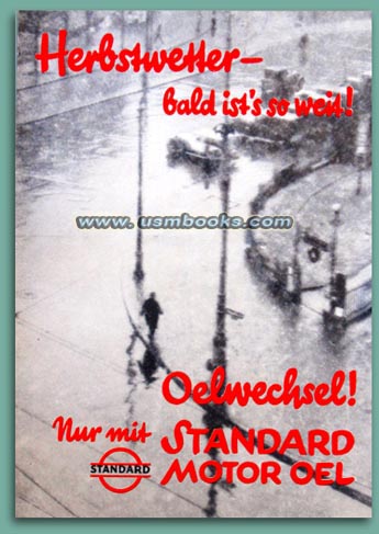
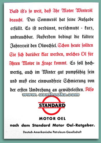
The 5-7/8 x 8-1/4 inch, two-sided flyer urged German motorists to change from summer to winter oil - produced by Standard Oil of course - since fall weather was near. The text on the back (shown left) explains the need to change from summer to winter oil and how its optimizes the performance of a car's engine.
Undated but absolutely original to Third Reich Nazi Germany. Almost all of these kinds of advertisements were quite naturally destroyed at the end of the war or used as evidence in court.
Rare and in very good condition, exactly as shown.
for $28.50 delivered by 1st Class Mail in the USA. |
| • IF you prefer faster and safer Priority Mail shipping with USPS Tracking add $8.95. |
| • IF you wish to purchase highly recommended, but optional insurance, add $3.50. |
| • We will be happy to ship abroad at additional cost, however foreign customers are responsible for any VAT payments, import duties & customs clearing fees. Please inquire. |
NAZI ERA ADVERTISING BY IG FARBEN PARTNER STANDARD OIL
THIRD REICH COLOR ADVERTISING FOR STANDARD OIL COMPANY,
PARTNER OF
IG FARBENINDUSTRIE
PARTNER OF
IG FARBENINDUSTRIE
|