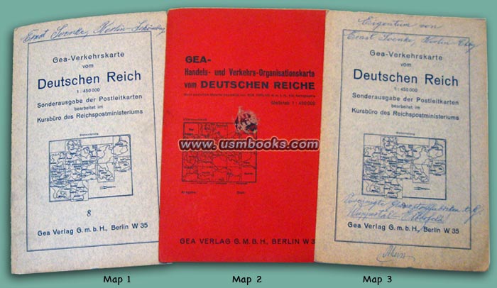

The three original Third Reich road maps offered for sale on this USMBOOKS web page were produced especially for the Nazi Postal Service not earlier than 1940.
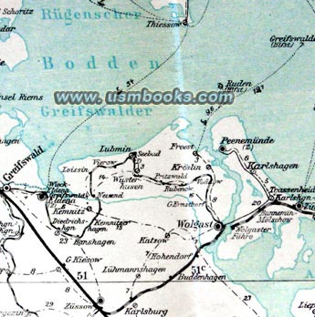
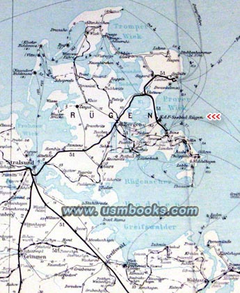
The red cover contains a map called the GEA Handels- und Verkehrs-Organisationskarte vom Deutschen Reiche covering the Postal District of Berlin (Reichspostdirektions-Bezirk Berlin) which included the Reichshauptstadt and a large area north and east of the city: Frankfurt /Oder, Stettin, all the way north to Peenemünde, Rostock and the island of Rügen where the Reinhard Heydrich family had a home. The KdF Seebad, the KdF resort on the island of Rügen built between 1936-1939 is marked.
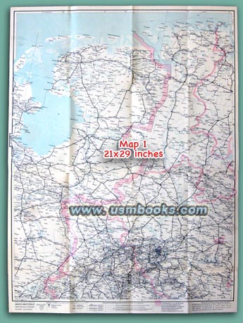
Gea-Verkehrskarte vom Deutschen Reich Sonderausgabe der Postleitkarten number 8 (shown as Map 1 on the photo at the top of this USMBOOKS web page) is a postal map covering the important industrial Ruhrgebiet of Nazi Germany and a large part of the Netherlands: Dusseldorf, Dortmund, Essen, Solingen, Lüdenscheid, all the way to Wilhelmshaven in the north and Amsterdam in the west.
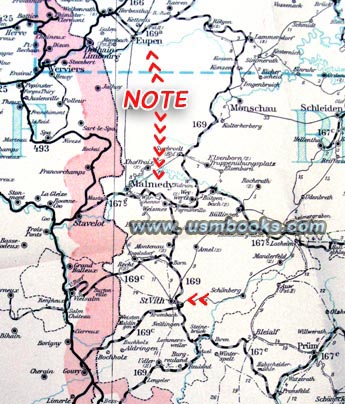
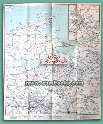
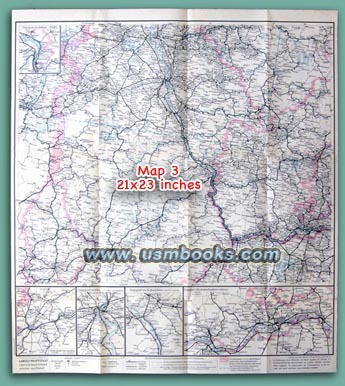
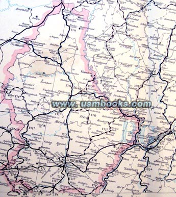
Gea-Verkehrskarte vom Deutschen Reich Sonderausgabe der Postleitkarten number 9 (shown as Map 3 on the photo at the top of this USMBOOKS web page) is a postal map covering the area directly south of the Ruhrgebiet: Aachen, Cologne, Trier, Koblenz, Frankfurt am Main all the way south to Luxembourg. It includes the area where the Battle of the Bulge was fought in 1944/45. The entire country of Luxembourg is shown as a part of Greater Germany (picture above).
Eupen, Malmédy and St. Vith are all shown as part of Germany while Verviers, site of the January 2015 police battle with Muslim extremists is shown in occupied Belgium - see photo directly above)
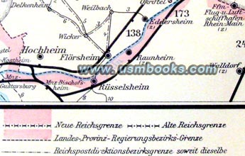
Published by Gea Verlag of Berlin for the Reichspostzentralamt in Berlin at a scale of 1:450 000. Neue und Alte Reichsgrenze (New and Old Borders of the Reich), postal district borders, postal bus routes, etc. are shown in great detail.
The Nazi map with the red cover is in very good condition. The maps in the light covers are also in very good condition but the covers have the handwritten name and address of a previous owner on them.

|
|
Have a look at other original Third Reich military and civilian maps
for sale on USMBOOKS.com.
for $75.00 delivered by 1st Class Mail in the continental USA. |
| • IF you prefer faster and safer Priority Mail shipping with USPS Tracking add $9.95. |
| • IF you wish to purchase highly recommended, but optional insurance, add $3.50. |
| • We will be happy to ship abroad at additional cost, however foreign customers are responsible for any VAT payments, import duties and clearing fees. Please inquire. |
LOT OF THREE ORIGINAL NAZI POSTAL DISTRICT MAPS
THREE ORIGINAL THIRD REICH GEA POSTAL MAPS - VERY DETAILED, VERY HISTORIC PARTS OF GREATER GERMANY