|
|
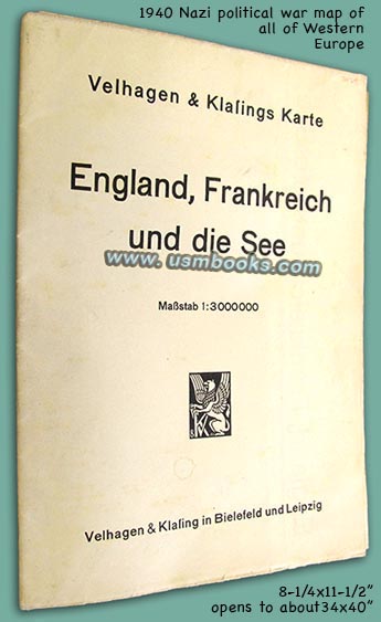
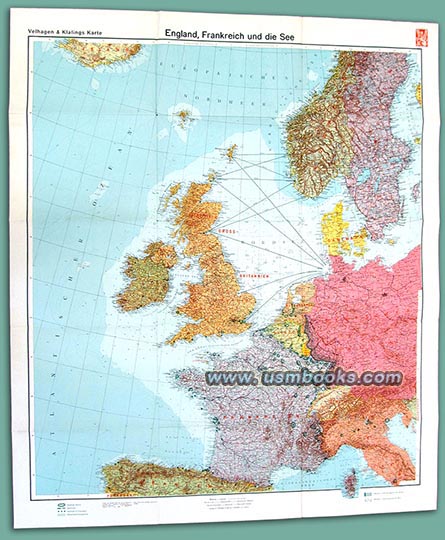
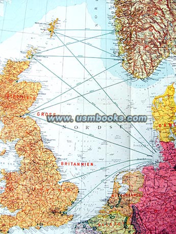
This original seven-color Nazi map was printed by the Velhagen & Klasing map company of Bielefeld and Leipzig in 1940. Folded up it measures 8-¼ x 11-1/2 inches, and when completely unfolded it measures 34 x 40 inches (87 x 102 cm). The scale is 1:3,000,000 (1 centimeter = 30 kilometers) and the countries shown on this Third Reich map are France, Great Britain, Belgium, Holland, Luxembourg, Switzerland, Greater Germany, northern Italy and Spain, a large part of Scandinavia and even the southern edge of Iceland.
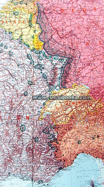
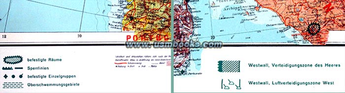
The map is dated 1940 in the lower right corner and the Nazi Westwall defenses are marked in green (see photo right). Also mentioned and marked on this map is the Verteidigungszone des Heeres or Defense Zone of the Army.

The publisher refers to it as a map giving a fantastic overview of the sea and trade war, not only covering the western powers but also showing northern and southern Europe.
This Nazi map has advertising for similar maps produced by Velhagen & Klasing (including the "Our Western Border with Siegfried Line and Maginot Line" and "The German East and Poland with German-Russian Interest Border!).
This 83 year old Third Reich color map is in very nice, little used condition with nice bright colors. No major tears, no tape, no discoloration, no odor. For anyone studying military or political aspects of Third Reich Germany and / or World War II in western Europe, this is a perfect map.
This 83 year old Third Reich color map is in very nice, little used condition with nice bright colors. No major tears, no tape, no discoloration, no odor. For anyone studying military or political aspects of Third Reich Germany and / or World War II in western Europe, this is a perfect map.
Have a look at a 1939 Nazi map of Germany's western borders and
other original Third Reich military and civilian maps for sale on
USMBOOKS.com. We are happy to combine shipping
of multiple purchases!
** SOLD ** |
| • IF you prefer faster and safer Priority Mail shipping with USPS Tracking add $8.95. |
| • IF you wish to purchase highly recommended, but optional insurance, add $3.50. |
| • We will be happy to ship abroad at additional cost, however foreign customers are responsible for any VAT payments, import duties and clearing fees. Please inquire. |
1940 NAZI MAP ENGLAND, FRANCE, ATLANTIC OCEAN
A LARGE THIRD REICH COLOR MAP OF EUROPE AND THE NORTH ATLANTIC DATED 1940