It is in good used condition, showing wear of normal use.
| This original Nazi DDAC map of southeastern Europe is **SOLD** |
|---|
| • IF you prefer faster and safer Priority Mail shipping with USPS Tracking add $6.70. |
| • IF you wish to purchase highly recommended, but optional insurance, add $3.25. |
| • We will be happy to ship abroad at additional cost. Please inquire. |
ORIGINAL DDAC NAZI HIGHWAY MAP OF SOUTHEASTERN EUROPE
VERY LATE-WAR ORIGINAL DDAC HIGHWAY MAP OF SOUTHEAST EUROPE

|
|
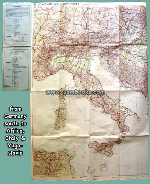
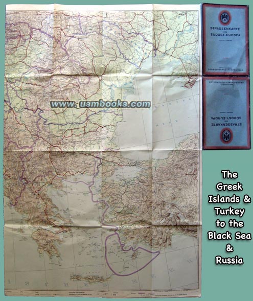
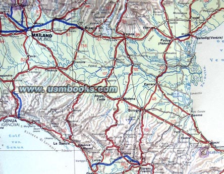
This is a spectacular multicolor Der Deutsche Automobil Club (DDAC, the AAA of Nazi Germany) Strassenkarte or highway map of all of southeastern Europe dated December 1943.
The 35 x 45 inch, 1 cm = 20 km (1:2,000,000) map shows the entire area of German occupied Europe from Sebastopol (Sewastopol) in the east to Prague (Prag, Praha), Luxembourg, Reims and Marseille in France to Algeria to Ankara in Turkey. Of course this includes Crete, Greece, Sicily, Sardinia, Corsica and all of Italy, Croatia, Serbia, Rumania, Hungary, Slovakia, Switzerland, etc.
The map shows all the Reichsautobahn sections that were under construction and completed. It also shows the new national borders in the former country of Yugoslavia