|
|
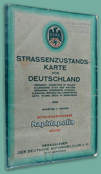
1939 COLOR ROAD MAP OF NAZI GERMANY FOR DDAC AUTO CLUB MEMBERS |
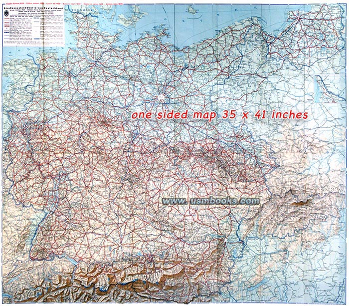
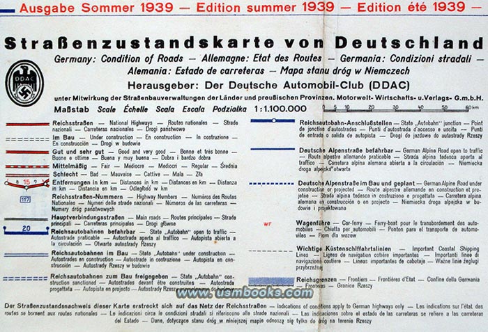
This full-color one-sided Nazi map was produced for members of the DDAC (Der Deutsche Automobilclub), the German Auto Club. Folded out, it measures 35 x 41 inches and is very detailed (scale 1:000,000). It was printed after the Anschluß when Austria was already part of Greater Germany, but before the 1939 invasion of Poland. Danzig is still shown as a separate entity (Freistaat Danzig) but the former Czechoslovakia is shown as Reichsgau Böhmen und Mähren as it had been incorporated into Nazi Germany. Slovakia is shown as a separate country.
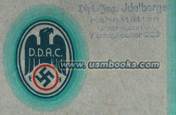
This original summer 1939 DDAC Strassenzustandskarte von Deutschland was printed by Jro-Verlag München Carl Kremling München. It was once owned by an engineer from Hahnstätten (east of Koblenz, north of Wiesbaden) named Idelberger who used -but not abused - it. Very nice used condition, no big tears, no tape, no fading, no odor.
Perfect for a Third Reich collector, historian or researcher!
Perfect for a Third Reich collector, historian or researcher!
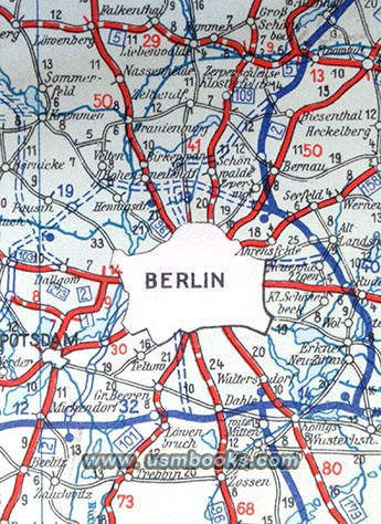 |
west, Oranienburg about 10 km north of the city and the huge Wehrmacht military complex at Zossen 30 miles south of the capital of Nazi Germany. |
This colorful historic Nazi map was printed in 1939 and shows Adolf Hitler's Germany the way it was just before World War II started.
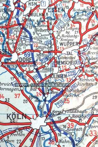
It is a historic 84 year old color road map of Nazi Germany showing the enormous progress made in the road network of the country during the first six years of National Socialist rule. The Reichsautobahn between the industrial Ruhrbegiet in the west to Reichshauptstadt Berlin was nearly finished, and the many stretches of Hitler’s freeways under construction were clearly marked on this map.
Germany was a popular tourist attraction in 1939, and this map was clearly printed with visitors in mind. Aside from German, the text on the map is printed in five other languages (English, French, Italian, Spanish and Polish).
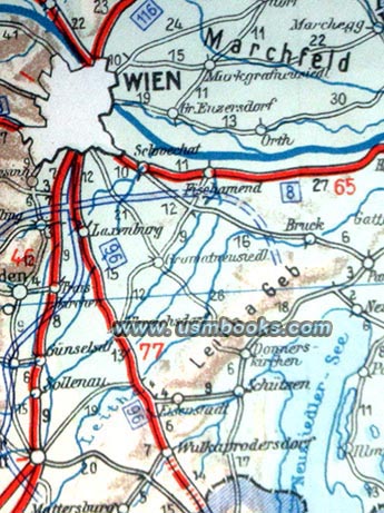
The map covers a huge area. The border with the country of Denmark is at the top, Königsberg in the northeast, Budapest in the southeast, northern Italy, Switzerland, eastern France, Luxembourg and Belgium, we well as a fairly large part of Holland in the west. It includes places like Danzig, Peenemünde, Warsaw, Litzmannstadt, Vienna, Budapest, Prague, Krakau, Przemysl, Bad Tölz, Munich, Dachau, Strassburg, Trier, Metz, etc.
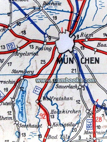 |
the concentration camp opened at Dachau in 1933 was only about 11 miles from the outskirts of Munich. The officers' training school for the Waffen-SS at Bad Tölz was 42 km south of The Capital of the Nazi Movement. |
Have a look at the 1938 edition of this DDAC map, as well as
many
other original Third Reich maps for sale on USMBOOKS.com.
We are happy to combine shipping of multiple purchases!
| • IF you prefer faster and safer Priority Mail shipping with USPS Tracking add $8.95. |
| • IF you wish to purchase highly recommended, but optional insurance, add $3.50. |
| • We will be happy to ship abroad at additional cost, however foreign customers are responsible for any VAT payments, import duties & customs clearing fees. Please inquire. |
ORIGINAL THIRD REICH SUMMER 1939 COLOR MAP
DDAC STRASSENZUSTANDSKARTE VON DEUTSCHLAND